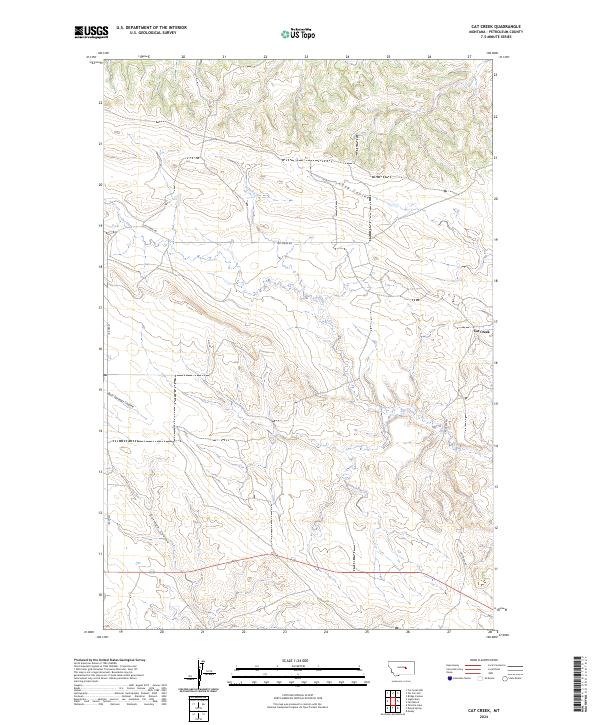
2024 Map of Cat Creek
USGS Topo · Published 2024About this map
Petroleum County's arid landscape is defined by the winding course of Cat Creek and the deep drainage of Long Coulee in this 2024 survey. The topography is dominated by a complex network of dry washes and canyons, including Bull Springs Coulee and Gorman Coulee, which shape the ranching and petroleum-rich terrain of central Montana. The small settlement of Cat Creek sits at the junction of the area's primary transit routes, notably Cat Creek Rd, which follows the contours of the creek itself. This map illustrates a region where the land use is dictated by the rugged hydrology of the Missouri River watershed, with Jitney Rd providing north-south access through the western portions of the quadrangle. The sparse distribution of man-made features highlights the open, rural character of the Big Sky country during the early twenty-first century.
Find a feature on this map
13 named features on this map. Tap any name to fly to it.
Don’t see what you’re looking for? This feature index may not catch every label — zoom into the map to look around manually.
Map Details
Editions of this 2024 Cat Creek Map
This is the sole edition of this map. No revisions or reprints were ever made.
Other maps of this area

1954 · Jordan
USGS Topo · 1:250,000

1954 · Forsyth
USGS Topo · 1:250,000

1954 · Roundup
USGS Topo · 1:250,000

1954 · Lewistown
USGS Topo · 1:250,000

1956 · Jordan
USGS Topo · 1:250,000

1957 · Forsyth
USGS Topo · 1:250,000

1958 · Jordan
USGS Topo · 1:250,000

1958 · Roundup
USGS Topo · 1:250,000

1958 · Forsyth
USGS Topo · 1:250,000

1959 · Lewistown
USGS Topo · 1:250,000