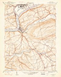
1947 Map of Catawissa
USGS Topo · Published 1947About this map
Catawissa serves as a central hub in this post-war landscape, where the Susquehanna River meets the winding Catawissa Creek. The 1940s economy of the region is clearly etched in the landscape, featuring a robust network of the Reading and Delaware Lackawanna and Western railroads supporting local industry. Industrial and community foundations are represented by Parrs Mill and Pensyls Mill along Roaring Creek, alongside numerous rural schoolhouses such as Tank Sch and Clayton Sch.
Find a feature on this map
51 named features on this map. Tap any name to fly to it.
Don’t see what you’re looking for? This feature index may not catch every label — zoom into the map to look around manually.
Map Details
Editions of this 1947 Catawissa Map
2 editions found
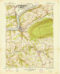
Other maps of this area

1889 · Catawissa
USGS Topo · 1:62,500

1892 · Catawissa
USGS Topo · 1:62,500

1892 · Shamokin
USGS Topo · 1:62,500

1893 · Shamokin
USGS Topo · 1:62,500

1894 · Catawissa
USGS Topo · 1:62,500

1894 · Bloomsburg
USGS Topo · 1:62,500

1935 · Hughesville
USGS Topo · 1:62,500

1943 · Shamokin
USGS Topo · 1:62,500

1947 · Bloomsburg
USGS Topo · 1:24,000

1947 · Ashland
USGS Topo · 1:24,000