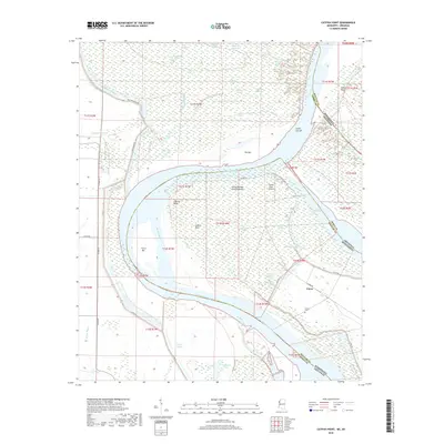
2018 Map of Catfish Point
USGS Topo · Published 2018About this map
The Mississippi River carves a complex, shifting path through the borderlands of Bolivar County and Desha County, defining a landscape of oxbows and riverbed remnants. The settlement of Eutaw sits protected by a network of earthen defenses, including the prominent Levee Rd, which separates the community from the flood-prone wetlands to the west. Near the river's edge, the Eutaw Cem provides a focal point for genealogical research in this alluvial region.
Find a feature on this map
55 named features on this map. Tap any name to fly to it.
Don’t see what you’re looking for? This feature index may not catch every label — zoom into the map to look around manually.
Map Details
Editions of this 2018 Catfish Point Map
This is the sole edition of this map. No revisions or reprints were ever made.
Other maps of this area

1933 · Lamont
USGS Topo · 1:62,500

1935 · Red Fork
USGS Topo · 1:62,500

1936 · McGehee
USGS Topo · 1:62,500

1937 · McGehee
USGS Topo · 1:62,500

1939 · Big Island
USGS Topo · 1:62,500

1939 · Lamont
USGS Topo · 1:62,500

1953 · Greenwood
USGS Topo · 1:250,000

1955 · McGehee
USGS Topo · 1:62,500

1956 · Greenwood
USGS Topo · 1:250,000
1969 · Kelso
USGS Topo · 1:24,000