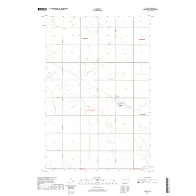
2018 Map of Cathay
USGS Topo · Published 2018About this map
Cathay centers this agricultural landscape in Wells County, where the township grid of the North American prairie meets a network of intermittent drainage and glacial potholes. The settlement is situated along a rail corridor that angles through the southeastern portion of the map, serving as a focal point for the surrounding farmsteads. To the northwest of the town site, Lake View Cem sits near the banks of Rocky Run, a seasonal waterway that winds across several sections. The map detail highlights the extensive wetlands and small basins characteristic of the region, interspersed with the straight-line paths of 14th St NE and 50th Ave NE. In the southernmost reaches, the terrain dips toward the headwaters of Pipestem Cr, illustrating the subtle hydrological divide of the central North Dakota plains.
Find a feature on this map
25 named features on this map. Tap any name to fly to it.
Don’t see what you’re looking for? This feature index may not catch every label — zoom into the map to look around manually.
Map Details
Editions of this 2018 Cathay Map
This is the sole edition of this map. No revisions or reprints were ever made.
Other maps of this area

1948 · Cathay
USGS Topo · 1:62,500

1948 · Fessenden
USGS Topo · 1:62,500

1948 · Bremen
USGS Topo · 1:24,000

1949 · Bremen
USGS Topo · 1:24,000

1949 · Cathay
USGS Topo · 1:24,000

1949 · Cathay SE
USGS Topo · 1:24,000

1949 · Fessenden East
USGS Topo · 1:24,000

1949 · Munster
USGS Topo · 1:24,000

1949 · Emrick
USGS Topo · 1:24,000

1951 · Heaton
USGS Topo · 1:24,000