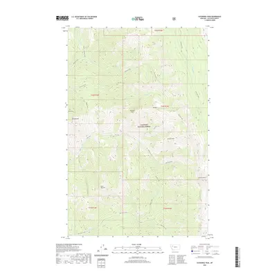
2020 Map of Cathedral Peak
USGS Topo · Published 2020About this map
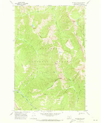
Flathead National Forest encompasses this high-altitude landscape in the northern Rockies, dominated by a series of prominent summits and drainage systems. Cathedral Peak stands at the center of the sheet, surrounded by other significant heights such as Minaret Peak to the southeast and Black Bear Mtn to the southwest. The terrain is defined by its complex hydrology, where Harrison Creek and Corporal Cr flow through northern valleys while Black Bear Creek and Rambler Creek drain the southern slopes. This 2020 survey illustrates a wilderness area largely devoid of permanent human settlements, instead showing the natural intersections of the Continental Divide's western reaches. The network of seasonal streams, including Lost Jack Creek and Silvertip Creek, suggests a landscape shaped by snowmelt and sharp elevation changes, typical of the high Flathead region.
Find a feature on this map
20 named features on this map. Tap any name to fly to it.
Don’t see what you’re looking for? This feature index may not catch every label — zoom into the map to look around manually.
Map Details
Editions of this 2020 Cathedral Peak Map
This is the sole edition of this map. No revisions or reprints were ever made.
Other maps of this area

1936 · Silvertip
USGS Topo · 1:96,000

1942 · Silvertip
USGS Topo · 1:125,000

1955 · Choteau
USGS Topo · 1:250,000

1957 · Choteau
USGS Topo · 1:250,000

1958 · Choteau
USGS Topo · 1:250,000

1962 · Choteau
USGS Topo · 1:250,000
1970 · Cathedral Peak
USGS Topo · 1:24,000
1970 · Marmot Mountain
USGS Topo · 1:24,000
1970 · Whitcomb Peak
USGS Topo · 1:24,000
1970 · Trilobite Peak
USGS Topo · 1:24,000