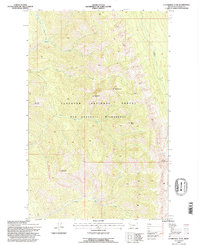
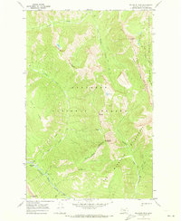
1994 Map of Cathedral Peak
USGS Topo · Published 1997About this map
Cathedral Peak stands as the central landmark in this high-altitude reach of the Flathead National Forest, part of the expansive Bob Marshall Wilderness as it was surveyed in the 1990s. The landscape is defined by its dramatic verticality, where sharp summits like Minaret Peak and Black Bear Mountain overlook a complex network of drainages. The hydrology of the region is dominated by streams such as Harrison Creek and Silvertip Creek, which flow through steep-walled valleys. Near Silvertip Mountain, a prominent Glacier remains visible, illustrating the perennial ice features that characterize this portion of the northern Rockies. The lack of roads or permanent structures reflects the protected wilderness status of the area, emphasizing a terrain where only trails and natural features like Meadow Mountain and Mid Mountain provide orientation for those navigating the backcountry.
Find a feature on this map
16 named features on this map. Tap any name to fly to it.
Don’t see what you’re looking for? This feature index may not catch every label — zoom into the map to look around manually.
Map Details
Editions of this 1994 Cathedral Peak Map
This is the sole edition of this map. No revisions or reprints were ever made.
Other maps of this area

1936 · Silvertip
USGS Topo · 1:96,000

1942 · Silvertip
USGS Topo · 1:125,000

1955 · Choteau
USGS Topo · 1:250,000

1957 · Choteau
USGS Topo · 1:250,000

1958 · Choteau
USGS Topo · 1:250,000

1962 · Choteau
USGS Topo · 1:250,000
1970 · Cathedral Peak
USGS Topo · 1:24,000
1970 · Marmot Mountain
USGS Topo · 1:24,000
1970 · Whitcomb Peak
USGS Topo · 1:24,000
1970 · Trilobite Peak
USGS Topo · 1:24,000