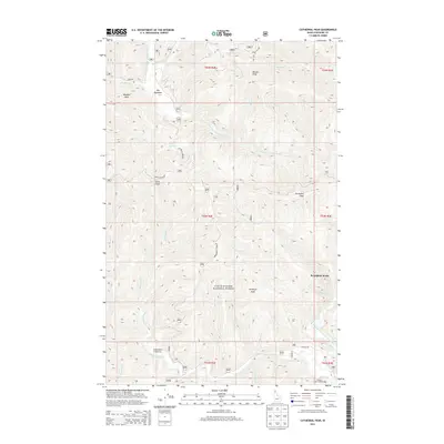
2013 Map of Cathedral Peak
USGS Topo · Published 2013About this map
Coeur d'Alene National Forest defines this high-altitude landscape in the Idaho Panhandle, dominated by the winding path of the N Fork Coeur d'Alene River and its numerous tributaries. The terrain is marked by prominent summits such as Cathedral Peak, Devil Peak, and Amethyst Peak, which rise above the deep drainage basins of Independence Creek and Tepee Creek. While much of the area is undeveloped forest land, the map documents small nodes of activity at Big Meadows and riverside recreational sites including Independence Campground and Senator Creek Campground. A network of forest roads, such as Tepee Cr Rd and the Spr Divide Rd, provides the primary access through the steep drainages of Cataract Cr and Emerson Cr. This survey captures the region's character as a managed wilderness area, highlighting the complex hydrography that feeds into the Coeur d'Alene river system.
Find a feature on this map
49 named features on this map. Tap any name to fly to it.
Don’t see what you’re looking for? This feature index may not catch every label — zoom into the map to look around manually.
Map Details
Editions of this 2013 Cathedral Peak Map
This is the sole edition of this map. No revisions or reprints were ever made.
Other maps of this area

1909 · Cataldo
USGS Topo · 1:125,000

1911 · Cataldo
USGS Topo · 1:125,000

1911 · Priest Lake
USGS Topo · 1:250,000

1913 · Priest Lake
USGS Topo · 1:250,000

1949 · Packsaddle Mtn
USGS Topo · 1:62,500

1951 · Packsaddle Mtn
USGS Topo · 1:62,500

1951 · Clark Fork
USGS Topo · 1:62,500

1955 · Spokane
USGS Topo · 1:250,000

1958 · Spokane
USGS Topo · 1:250,000

1958 · Sandpoint
USGS Topo · 1:250,000