
1958 Map of Catherine Island
USGS Topo · Published 1959About this map
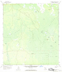
Pennington Post Camp stands as one of the few named outposts in this vast wetland landscape, reflecting a time when this part of Collier County was largely inaccessible except by specialized watercraft or via specialized camps. The terrain is dominated by complex systems of strands and hammocks, including the Stumpy Strand and the extensive Fakahatchee Strand. These watery corridors are punctuated by slightly elevated "islands" such as Catherine Island and Rock Spring Island.
Find a feature on this map
23 named features on this map. Tap any name to fly to it.
Don’t see what you’re looking for? This feature index may not catch every label — zoom into the map to look around manually.
Map Details
Editions of this 1958 Catherine Island Map
3 editions found
Other maps of this area

1956 · West Palm Beach
USGS Topo · 1:250,000

1957 · West Palm Beach
USGS Topo · 1:250,000

1958 · West Palm Beach
USGS Topo · 1:250,000

1958 · Corkscrew SE
USGS Topo · 1:24,000

1958 · Sunniland
USGS Topo · 1:24,000

1958 · Belle Meade NE
USGS Topo · 1:24,000

1958 · Immokalee SW
USGS Topo · 1:24,000

1958 · Belle Meade SE
USGS Topo · 1:24,000

1959 · Miles City
USGS Topo · 1:24,000

1959 · Deep Lake
USGS Topo · 1:24,000