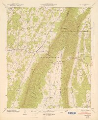
1947 Map of Catlett
USGS Topo · Published 1947About this map
Taylor Ridge bisects this Northwest Georgia landscape, separating the Tennessee Valley from the West Armuchee Valley. The terrain is characterized by a series of parallel ridges and narrow valleys, where small farming communities and educational centers like Catlett and Hickory Hill Sch took root. The Chattahoochee National Forest encompasses much of the higher elevations, including Lookout Mountain where a Lookout Tower stands near the Walker and Whitfield County line.
Find a feature on this map
70 named features on this map. Tap any name to fly to it.
Don’t see what you’re looking for? This feature index may not catch every label — zoom into the map to look around manually.
Map Details
Editions of this 1947 Catlett Map
2 editions found
Other maps of this area

1886 · Ringgold
USGS Topo · 1:125,000

1892 · Ringgold
USGS Topo · 1:125,000

1935 · Catlett
USGS Topo · 1:24,000

1935 · Villanow
USGS Topo · 1:24,000

1935 · Nickajack Gap
USGS Topo · 1:24,000

1935 · Tunnel Hill
USGS Topo · 1:24,000

1936 · Kensington
USGS Topo · 1:24,000

1936 · Estelle
USGS Topo · 1:24,000
1943 · Tunnel Hill
USGS Topo · 1:24,000

1946 · Kensington
USGS Topo · 1:24,000