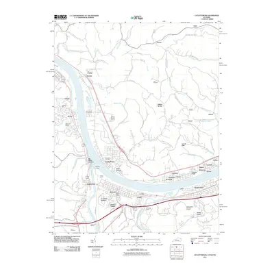
2011 Map of Catlettsburg
USGS Topo · Published 2011About this map
Catlettsburg and Kenova anchor the confluence of the Ohio River and Big Sandy River, a critical transportation and industrial junction where Kentucky, Ohio, and West Virginia meet. This early 21st-century landscape is dominated by heavy infrastructure and river-based industry, most notably the Ashland Oil Refinery at the southern edge and the National Steel-Ohio River Site Dam. The map details the dense rail network of CSX Transportation as it navigates the tri-state riverbanks, connecting industrial centers like Ceredo and North Kenova with residential neighborhoods such as Oakview Heights and Grandview Gardens. Genealogists will find numerous dedicated burial grounds, including Green Lawn Cemetery, Macedonia Cemetery, and Alley Cemetery. Away from the river valleys, the terrain rises into the hills of Cartrell Hill and Crescent Hill, where smaller communities like Sulphur Springs and Possum Hollow are reached by winding ridge roads like Sutton Mt Taber Ridge Rd.
Find a feature on this map
102 named features on this map. Tap any name to fly to it.
Don’t see what you’re looking for? This feature index may not catch every label — zoom into the map to look around manually.
Map Details
Editions of this 2011 Catlettsburg Map
This is the sole edition of this map. No revisions or reprints were ever made.
Other maps of this area

1892 · Huntington
USGS Topo · 1:125,000

1898 · Huntington
USGS Topo · 1:125,000

1898 · Ironton
USGS Topo · 1:62,500

1900 · Ironton
USGS Topo · 1:62,500

1901 · Guyandot
USGS Topo · 1:62,500

1901 · Ceredo
USGS Topo · 1:62,500

1902 · Guyandot
USGS Topo · 1:62,500

1903 · Kenova
USGS Topo · 1:125,000

1904 · Kenova
USGS Topo · 1:125,000

1906 · Athalia
USGS Topo · 1:62,500