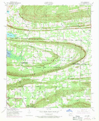
1953 Map of Cato
USGS Topo · Published 1971About this map
The boundary between Faulkner and Pulaski counties bisects a landscape defined by significant military and rural transitions. Large portions of the terrain are designated as a National Guard Training Area, including the site of Former Camp J T Robinson. This military reservation is characterized by topographic landmarks like Clifton Mountain and the prominent Cato Point. Outside the reservation boundaries, the rural character of the region is preserved through small settlements and corner communities. Rural life is anchored by institutions such as Oakwood Church, Shaw School, and the Mt Payam Cemetery. The northwestern corner features the southern reaches of Lake Conway, while a network of creeks, including White Oak Bayou and Kellogg Creek, drain the southern valleys. Significant local routes like the Little Rock Road and Mayflower Olmstead Road connect these scattered homesteads and crossroad communities.
Find a feature on this map
43 named features on this map. Tap any name to fly to it.
Don’t see what you’re looking for? This feature index may not catch every label — zoom into the map to look around manually.
Map Details
Editions of this 1953 Cato Map
4 editions found
Other maps of this area

1891 · Little Rock
USGS Topo · 1:125,000

1893 · Little Rock
USGS Topo · 1:125,000

1935 · Mc Almont
USGS Topo · 1:24,000

1935 · North Little Rock
USGS Topo · 1:24,000

1941 · Olmstead
USGS Topo · 1:31,680

1943 · Pinnacle Mtn
USGS Topo · 1:31,680

1953 · Cato
USGS Topo · 1:24,000

1953 · Mayflower
USGS Topo · 1:24,000
1954 · Pinnacle Mountain
USGS Topo · 1:24,000

1954 · Mc Almont
USGS Topo · 1:24,000