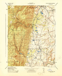
1944 Map of Catoctin Furnace
USGS Topo · Published 1944About this map
Catoctin Furnace serves as a historic focal point at the base of the mountains in this mid-1940s survey. The landscape is defined by the contrast between the steep, wooded slopes of the Blue Ridge Summit and the agricultural valley to the east. Water management and conservation efforts are prominent, shown by the Fishing Creek Reservoir tucked into the highlands and the Lewistown State Fish Hatchery near the center of the sheet.
Find a feature on this map
46 named features on this map. Tap any name to fly to it.
Don’t see what you’re looking for? This feature index may not catch every label — zoom into the map to look around manually.
Map Details
Editions of this 1944 Catoctin Furnace Map
This is the sole edition of this map. No revisions or reprints were ever made.
Other maps of this area

1884 · Harpers Ferry
USGS Topo · 1:125,000

1891 · Harpers Ferry
USGS Topo · 1:125,000

1893 · Frederick
USGS Topo · 1:125,000

1893 · Harpers Ferry
USGS Topo · 1:125,000

1894 · Frederick
USGS Topo · 1:125,000

1908 · Middletown
USGS Topo · 1:48,000

1908 · Ijamsville
USGS Topo · 1:62,500

1909 · Ijamsville
USGS Topo · 1:62,500

1909 · Hagerstown
USGS Topo · 1:48,000

1910 · Antietam
USGS Topo · 1:62,500