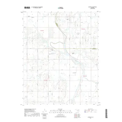
2019 Map of Catoosa SE
USGS Topo · Published 2019About this map
The Verdigris River snakes through the center of this landscape, defining the low-lying terrain of northeastern Oklahoma. The river's influence is evident in the expansive alluvial plains known as Big Bottom, Goodhope Bottom, and Guinn Bottom, which dominate the central and southern portions of the quadrangle. These areas are complemented by several water bodies, including the aptly named Pecan Slough and Snake Den Lake, the latter situated just below the prominent Snake Den Bluff.
Find a feature on this map
48 named features on this map. Tap any name to fly to it.
Don’t see what you’re looking for? This feature index may not catch every label — zoom into the map to look around manually.
Map Details
Editions of this 2019 Catoosa SE Map
This is the sole edition of this map. No revisions or reprints were ever made.
Other maps of this area

1896 · Okmulgee
USGS Topo · 1:125,000

1896 · Pryor
USGS Topo · 1:125,000

1900 · Okmulgee
USGS Topo · 1:125,000

1901 · Muscogee
USGS Topo · 1:125,000

1901 · Claremore
USGS Topo · 1:125,000

1901 · Pryor
USGS Topo · 1:125,000

1905 · Muscogee
USGS Topo · 1:125,000

1914 · Claremore
USGS Topo · 1:125,000

1916 · Claremore
USGS Topo · 1:125,000

1946 · Fort Smith
USGS Topo · 1:250,000