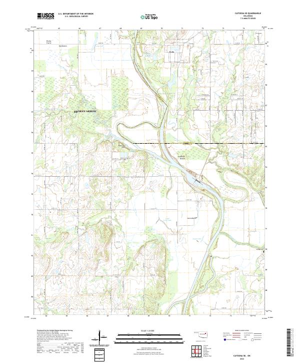
2022 Map of Catoosa SE
USGS Topo · Published 2022About this map
The Verdigris River snakes through this landscape on the border of Rogers and Wagoner Counties, shaping a topography of fertile lowlands and distinctive bluffs. The eastern edge of Broken Arrow meets the rural agricultural community of Inola, illustrating the modern intersection of suburban expansion and traditional Oklahoma ranch land. Along the river's course, the terrain is defined by broad alluvial flats such as Big Bottom, Goodhope Bottom, and Guinn Bottom, which are punctuated by seasonal water features like Pecan Slough and Legas Lake.
Find a feature on this map
72 named features on this map. Tap any name to fly to it.
Don’t see what you’re looking for? This feature index may not catch every label — zoom into the map to look around manually.
Map Details
Editions of this 2022 Catoosa SE Map
This is the sole edition of this map. No revisions or reprints were ever made.
Other maps of this area

1896 · Okmulgee
USGS Topo · 1:125,000

1896 · Pryor
USGS Topo · 1:125,000

1900 · Okmulgee
USGS Topo · 1:125,000

1901 · Muscogee
USGS Topo · 1:125,000

1901 · Claremore
USGS Topo · 1:125,000

1901 · Pryor
USGS Topo · 1:125,000

1905 · Muscogee
USGS Topo · 1:125,000

1914 · Claremore
USGS Topo · 1:125,000

1916 · Claremore
USGS Topo · 1:125,000

1946 · Fort Smith
USGS Topo · 1:250,000