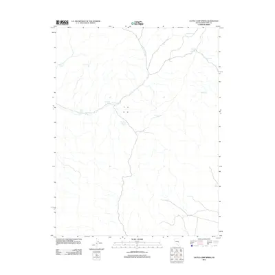
2012 Map of Cattle Camp Spring
USGS Topo · Published 2012About this map
Cattle Camp Spring and its surrounding watershed define this high-desert reach of White Pine County, where water sources dictated the patterns of movement and land use. The topography is dominated by the drainage system of Cattle Camp Wash, which cuts across the landscape, drawing from numerous named seeps and springs. These isolated water points, such as Virginia Dale Spring and Lake Valley Summit Spring, were likely critical landmarks for early ranching operations and travelers navigating the basin and range terrain. The distribution of these features, including Burnt Knoll Spring and Monument Spring, reveals the essential network of life-sustaining points in an otherwise arid environment. This 2012 survey provides a clear view of the local drainage and high-elevation hydrology, emphasizing the importance of even minor features like Little Pine Spring and Lower Spring in the regional geography.
Find a feature on this map
13 named features on this map. Tap any name to fly to it.
Don’t see what you’re looking for? This feature index may not catch every label — zoom into the map to look around manually.
Map Details
Editions of this 2012 Cattle Camp Spring Map
This is the sole edition of this map. No revisions or reprints were ever made.
Other maps of this area

1956 · Lund
USGS Topo · 1:250,000

1960 · Lund
USGS Topo · 1:250,000

1969 · Parker Station
USGS Topo · 1:24,000
1973 · White Rock Creek
USGS Topo · 1:24,000

1973 · Cattle Camp Spring
USGS Topo · 1:24,000
1973 · North Spring Point
USGS Topo · 1:24,000
1973 · Mount Grafton NE
USGS Topo · 1:24,000
1973 · Horse Camp Springs
USGS Topo · 1:24,000
1977 · Bullwhack Summit
USGS Topo · 1:24,000
1978 · Mt. Grafton
USGS Topo · 1:24,000