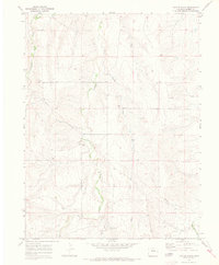
1970 Map of Cattle Gulch
USGS Topo · Published 1973About this map
Middle Bijou Creek and its neighboring drainage systems define this section of the High Plains on the border of Elbert and Arapahoe Counties. The landscape is dominated by a series of north-south running seasonal watercourses, including Wilson Creek, Cattle Gulch, and Keg Creek, which carve through the undulating prairie terrain. In 1970, this area remained primarily agricultural and open range, characterized by large land sections and a sparse network of unimproved roads. Traces of utility and industrial infrastructure are evident in the diagonal Pipeline crossing the western hills and several Gravel Pits located near the streambeds. The map captures the quiet rural character of the region before significant modern development, showing the subtle topographic variations between the East Bijou Creek and Bland Creek drainages.
Find a feature on this map
9 named features on this map. Tap any name to fly to it.
Don’t see what you’re looking for? This feature index may not catch every label — zoom into the map to look around manually.
Map Details
Editions of this 1970 Cattle Gulch Map
4 editions found
Other maps of this area

1891 · Limon
USGS Topo · 1:125,000

1892 · Limon
USGS Topo · 1:125,000

1953 · Denver
USGS Topo · 1:250,000

1954 · Limon
USGS Topo · 1:250,000

1957 · Denver
USGS Topo · 1:250,000

1957 · Limon
USGS Topo · 1:250,000

1958 · Limon
USGS Topo · 1:250,000

1958 · Denver
USGS Topo · 1:250,000

1960 · Denver
USGS Topo · 1:250,000

1968 · Deer Trail
USGS Topo · 1:24,000