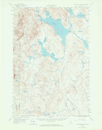
1958 Map of Caucomgomoc Lake
USGS Topo · Published 1966About this map
Caucomgomoc Lake dominates this 1958 survey of the Maine North Woods, a landscape defined by its complex network of waterways and timber-management infrastructure. The topography is shaped by prominent peaks such as Caucomgomoc Mtn and Mucalsea Mtn, while the human presence is marked by several dams, including Caucomgomoc Dam and Loon Lake Dam, which regulate the flow through Caucomgomoc Stream and various deadwaters. The region's isolation and reliance on resource extraction are evident in the presence of a Private Road network and Gravel Pits scattered near the stream beds. These features, alongside specialized topographical descriptors like The Horserace and Cassidy Deadwater, illustrate the specific terminology used by woodsmen and hydrologists in the mid-century Maine wilderness.
Find a feature on this map
75 named features on this map. Tap any name to fly to it.
Don’t see what you’re looking for? This feature index may not catch every label — zoom into the map to look around manually.
Map Details
Editions of this 1958 Caucomgomoc Lake Map
4 editions found

Other maps of this area

1954 · Seboomook Lake
USGS Topo · 1:62,500

1954 · Chesuncook
USGS Topo · 1:62,500

1954 · North East Carry
USGS Topo · 1:62,500

1954 · Baker Lake
USGS Topo · 1:62,500

1954 · Caucomgomoc Lake
USGS Topo · 1:62,500

1954 · Churchill Lake
USGS Topo · 1:62,500

1954 · Allagash Lake
USGS Topo · 1:62,500

1954 · St. John Pond
USGS Topo · 1:62,500

1954 · Grant Farm
USGS Topo · 1:62,500

1954 · Presque Isle
USGS Topo · 1:250,000