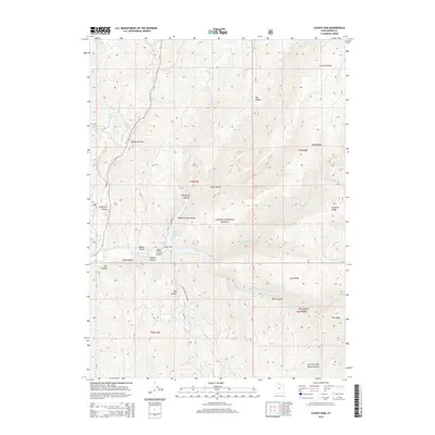
2014 Map of Causey Dam
USGS Topo · Published 2014About this map
Causey Dam stands as a central engineering feature within this high-elevation landscape of the Cache National Forest. The impounded waters of the Causey Reservoir are fed by a complex drainage system, including the S Fork Ogden River and its tributaries like the Left Fork S Fork Ogden River. This 2014 survey captures a terrain defined by steep ridges and narrow canyons, where named features often reflect local family histories or physical characteristics, such as Jorgensen Hollow, Pete Nelson Hollow, and the evocative Skull Crack Canyon. Transportation is limited to a few arterial routes like E Hwy 39 and unpaved access ways such as Burma Rd and Skull Crack Canyon Rd. The map illustrates a transitional environment where the open expanse of Sagebrush Flat meets the high elevations of Lightning Ridge and Baldy Ridge.
Find a feature on this map
41 named features on this map. Tap any name to fly to it.
Don’t see what you’re looking for? This feature index may not catch every label — zoom into the map to look around manually.
Map Details
Editions of this 2014 Causey Dam Map
This is the sole edition of this map. No revisions or reprints were ever made.
Other maps of this area

1954 · Ogden
USGS Topo · 1:250,000

1958 · Ogden
USGS Topo · 1:250,000

1960 · Ogden
USGS Topo · 1:250,000
1961 · Morgan
USGS Topo · 1:62,500
1964 · Lost Creek Dam
USGS Topo · 1:24,000
1964 · Monte Cristo PK
USGS Topo · 1:24,000
1964 · Sharp Mountain
USGS Topo · 1:24,000
1964 · Browns Hole
USGS Topo · 1:24,000
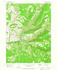
1964 · Causey Dam
USGS Topo · 1:24,000
1968 · Horse Ridge
USGS Topo · 1:24,000