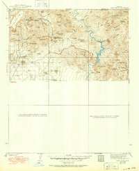
1939 Map of Cave Creek
USGS Topo · Published 1950About this map
Cavecreek and the high desert of the Tonto National Forest are documented here during the late 1920s and 1930s. The landscape is defined by the drainage systems of the Verde River, Cave Creek, and New River, where early ranching and mining shaped the remote topography. Ranching life is particularly visible through properties such as the Cartwright Ranch and Lewis Ranch, while the Spur Cross Dude Ranch marks the era's growing interest in western recreation. For genealogists and mining historians, the location of the Mormon Girl Mine and the Ashdale Ranger Sta provide specific points of reference for early twentieth-century activity. The map traces the county line between Yavapai and Maricopa, showing a network of primitive roads reaching toward Seven Springs and various forest service recreation areas.
Find a feature on this map
83 named features on this map. Tap any name to fly to it.
Don’t see what you’re looking for? This feature index may not catch every label — zoom into the map to look around manually.
Map Details
Editions of this 1939 Cave Creek Map
3 editions found

Other maps of this area

1887 · Verde
USGS Topo · 1:250,000

1887 · Prescott
USGS Topo · 1:250,000

1892 · Verde
USGS Topo · 1:250,000

1892 · Prescott
USGS Topo · 1:250,000

1900 · Florence
USGS Topo · 1:125,000

1902 · Florence
USGS Topo · 1:125,000

1903 · Bradshaw Mountains
USGS Topo · 1:125,000

1904 · Camelback
USGS Topo · 1:62,500

1904 · Desert Well
USGS Topo · 1:62,500

1904 · Ft. McDowell
USGS Topo · 1:62,500