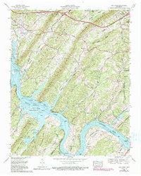
1968 Map of Cave Creek
USGS Topo · Published 1990About this map
Watts Bar Lake and the winding Tennessee River dominate this landscape, which straddles the Roane and Loudon county line. The 1968 survey illustrates a transition from the historic riverine environment to the managed waters of the Watts Bar Wildlife Management Area, showing numerous islands like Matlock Island and Huffine Island within the reservoir. To the north, the terrain is defined by a series of parallel ridges including Chestnut Ridge and Copper Ridge, where small rural communities and family burial grounds are situated.
Find a feature on this map
61 named features on this map. Tap any name to fly to it.
Don’t see what you’re looking for? This feature index may not catch every label — zoom into the map to look around manually.
Map Details
Editions of this 1968 Cave Creek Map
3 editions found
Other maps of this area

1887 · Kingston
USGS Topo · 1:125,000

1891 · Kingston
USGS Topo · 1:125,000

1893 · Kingston
USGS Topo · 1:125,000

1895 · Loudon
USGS Topo · 1:125,000

1935 · Lenoir City
USGS Topo · 1:24,000

1935 · Elverton
USGS Topo · 1:24,000

1935 · Bethel Valley
USGS Topo · 1:24,000

1935 · Harriman
USGS Topo · 1:24,000

1935 · Philadelphia
USGS Topo · 1:24,000

1936 · Cave Creek
USGS Topo · 1:24,000