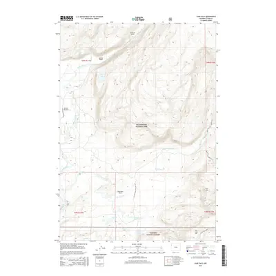
2015 Map of Cave Falls
USGS Topo · Published 2015About this map
Yellowstone National Park and Targhee National Forest meet in this landscape defined by the convergence of the Fall River and Bechler River systems. This region is remarkably water-rich, featuring a concentration of named cascades including Iris Falls, Colonnade Falls, Ouzel Falls, and Rainbow Falls. The southwest corner of the park is anchored by Cave Falls, while the northern reaches include Treasure Island and the Bechler Canyon. Human movement through this remote backcountry is traced by established routes like the Bechler Meadows Trail and the Fish Lake-Mount Ash Cutoff Trail. The map documents a complex hydrology where high-elevation lakes such as Winegar Lake, Fish Lake, and Rock Lake feed into the Falls River Basin. The presence of the Ashton-Flagg Ranch road provides a vital link between these protected federal lands.
Find a feature on this map
35 named features on this map. Tap any name to fly to it.
Don’t see what you’re looking for? This feature index may not catch every label — zoom into the map to look around manually.
Map Details
Editions of this 2015 Cave Falls Map
This is the sole edition of this map. No revisions or reprints were ever made.
Other maps of this area

1886 · Shoshone
USGS Topo · 1:125,000

1888 · Shoshone
USGS Topo · 1:125,000

1895 · Shoshone
USGS Topo · 1:125,000

1901 · Shoshone
USGS Topo · 1:125,000

1908 · Shoshone
USGS Topo · 1:125,000

1911 · Shoshone
USGS Topo · 1:125,000

1955 · Ashton
USGS Topo · 1:250,000

1956 · Old Faithful
USGS Topo · 1:62,500

1956 · Grassy Lake Reservoir
USGS Topo · 1:62,500

1957 · Warm River Butte
USGS Topo · 1:62,500