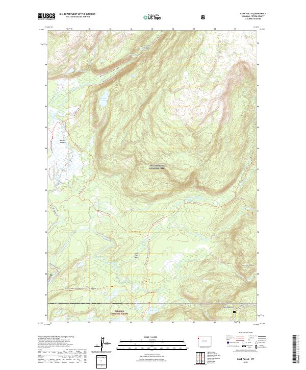
2021 Map of Cave Falls
USGS Topo · Published 2021About this map
Yellowstone National Park and Targhee National Forest meet in this remote corner of Wyoming, defined by a complex network of waterfalls and river basins. The Bechler River carves through the Bechler Canyon and feeds into the expansive Bechler Meadows, a terrain marked by numerous tributaries and seasonal wetlands. Significant hydrological features including Colonnade Falls, Ouzel Falls, and Rainbow Falls demonstrate the dramatic elevation changes throughout the quadrangle.
Find a feature on this map
38 named features on this map. Tap any name to fly to it.
Don’t see what you’re looking for? This feature index may not catch every label — zoom into the map to look around manually.
Map Details
Editions of this 2021 Cave Falls Map
This is the sole edition of this map. No revisions or reprints were ever made.
Other maps of this area

1886 · Shoshone
USGS Topo · 1:125,000

1888 · Shoshone
USGS Topo · 1:125,000

1895 · Shoshone
USGS Topo · 1:125,000

1901 · Shoshone
USGS Topo · 1:125,000

1908 · Shoshone
USGS Topo · 1:125,000

1911 · Shoshone
USGS Topo · 1:125,000

1955 · Ashton
USGS Topo · 1:250,000

1956 · Old Faithful
USGS Topo · 1:62,500

1956 · Grassy Lake Reservoir
USGS Topo · 1:62,500

1957 · Warm River Butte
USGS Topo · 1:62,500