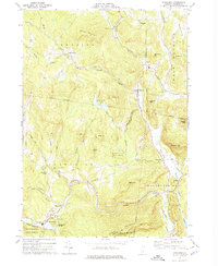
1972 Map of Cavendish
USGS Topo · Published 1974About this map
The Black River winds through this 1972 survey of Windsor County, following a path that historically dictated the placement of industry and settlements. In the southwest corner, the village of Cavendish sits near the dramatic Cavendish Gorge, while the North Branch flows through the heart of Reading and Hammondsville. The landscape is a network of ridges and high points, including Keyes Mountain and Hardy Hill, interspersed with small dairy-era settlements like South Reading and Felchville.
Find a feature on this map
55 named features on this map. Tap any name to fly to it.
Don’t see what you’re looking for? This feature index may not catch every label — zoom into the map to look around manually.
Map Details
Editions of this 1972 Cavendish Map
3 editions found
Other maps of this area

1906 · Hanover
USGS Topo · 1:62,500

1908 · Hanover
USGS Topo · 1:62,500

1911 · Woodstock
USGS Topo · 1:62,500

1913 · Woodstock
USGS Topo · 1:62,500

1926 · Claremont
USGS Topo · 1:62,500

1928 · Ludlow
USGS Topo · 1:48,000

1929 · Claremont
USGS Topo · 1:62,500

1929 · Ludlow
USGS Topo · 1:62,500

1932 · Ludlow
USGS Topo · 1:62,500

1943 · Woodstock
USGS Topo · 1:62,500