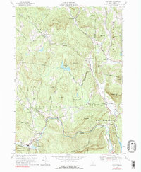
1972 Map of Cavendish
USGS Topo · Published 1991About this map
The Black River and its North Branch define the settlement patterns of this Vermont landscape, where small villages like Felchville, Amsden, and Downers are connected by winding valley roads. The area is marked by significant topographical relief, including the heights of Hawks Mountain and Little Ascutney Mtn. Genealogists and local historians will find value in the documentation of the Old Revolutionary War Cem and Mt Union Ch, which speak to the deep history of early Vermont settlers in the townships of Reading and Cavendish. The industrial utility of the river is evident at Whitesville, where a Powerplant and Sewage Disposal facility are located near the dramatic Cavendish Gorge. Conservation efforts are well-established here, with the Albert C Lord State Forest and Proctor-Piper State Forest preserving large tracts of timberland.
Find a feature on this map
54 named features on this map. Tap any name to fly to it.
Don’t see what you’re looking for? This feature index may not catch every label — zoom into the map to look around manually.
Map Details
Editions of this 1972 Cavendish Map
3 editions found
Other maps of this area

1906 · Hanover
USGS Topo · 1:62,500

1908 · Hanover
USGS Topo · 1:62,500

1911 · Woodstock
USGS Topo · 1:62,500

1913 · Woodstock
USGS Topo · 1:62,500

1926 · Claremont
USGS Topo · 1:62,500

1928 · Ludlow
USGS Topo · 1:48,000

1929 · Claremont
USGS Topo · 1:62,500

1929 · Ludlow
USGS Topo · 1:62,500

1932 · Ludlow
USGS Topo · 1:62,500

1943 · Woodstock
USGS Topo · 1:62,500