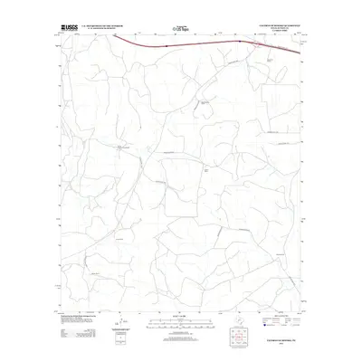
2012 Map of Caverns of Sonora
USGS Topo · Published 2012About this map
Valliant Ranch and Locklin Ranch occupy this segment of the Edwards Plateau in Sutton County, where the landscape is defined by vast rangelands and seasonal drainage patterns. The 2012 survey illustrates a region largely partitioned into large family holdings, connected by a network of private roads like Private Road 4470 and Private Road 1125. Major transit is limited to the northern edge along Ranch Road 1312 and Ranch Road 1989. The distribution of ranch headquarters, including Simmons Ranch and the Mayer Number Nine Ranch, reflects the enduring pastoral character of this West Texas territory. Genealogists and land historians can trace property boundaries and access routes through this rugged limestone terrain, where traditional ranching operations like the Fawcett Ranch and Ingham Ranch have persisted into the modern era.
Find a feature on this map
18 named features on this map. Tap any name to fly to it.
Don’t see what you’re looking for? This feature index may not catch every label — zoom into the map to look around manually.
Map Details
Editions of this 2012 Caverns of Sonora Map
This is the sole edition of this map. No revisions or reprints were ever made.
Other maps of this area

1954 · Sonora
USGS Topo · 1:250,000

1958 · Sonora
USGS Topo · 1:250,000

1964 · Sonora
USGS Topo · 1:24,000

1964 · Sonora NW
USGS Topo · 1:24,000

1967 · Nolen Draw
USGS Topo · 1:24,000

1967 · Savell Ranch
USGS Topo · 1:24,000

1967 · Dunbar Draw NW
USGS Topo · 1:24,000

1967 · Shafter Draw
USGS Topo · 1:24,000

1967 · Hudspeth Draw
USGS Topo · 1:24,000

1967 · Caverns Of Sonora
USGS Topo · 1:24,000