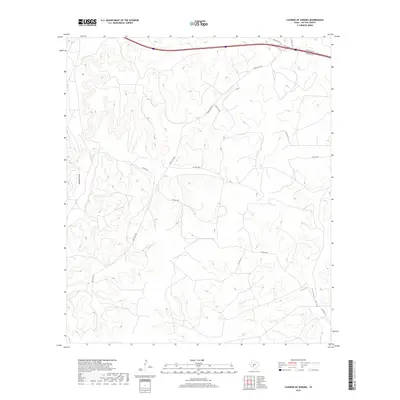
2019 Map of Caverns of Sonora
USGS Topo · Published 2019About this map
Granger Draw and Halbert Draw carve through the Edwards Plateau in this modern survey of Sutton County. The landscape is defined by a dense network of private ranch roads, including Pvt Rd 4470 and Pvt Rd 1124, which provide access to the high, undulating divides between the seasonal drainage channels. The primary thoroughfare, Ranch Rd 1989, winds through the northern section, connecting the isolated homesteads and ranching operations that characterize this region of West Texas. This map provides a precise view of contemporary land divisions and topographical contours, illustrating how human infrastructure like Pvt Rd 4468 and Pvt Rd 4413 adapts to the natural draws and ridges. It is an essential document for understanding modern land use and ranching boundaries in the vicinity of the famous limestone cavern system.
Find a feature on this map
12 named features on this map. Tap any name to fly to it.
Don’t see what you’re looking for? This feature index may not catch every label — zoom into the map to look around manually.
Map Details
Editions of this 2019 Caverns of Sonora Map
This is the sole edition of this map. No revisions or reprints were ever made.
Other maps of this area

1954 · Sonora
USGS Topo · 1:250,000

1958 · Sonora
USGS Topo · 1:250,000

1964 · Sonora
USGS Topo · 1:24,000

1964 · Sonora NW
USGS Topo · 1:24,000

1967 · Nolen Draw
USGS Topo · 1:24,000

1967 · Savell Ranch
USGS Topo · 1:24,000

1967 · Dunbar Draw NW
USGS Topo · 1:24,000

1967 · Shafter Draw
USGS Topo · 1:24,000

1967 · Hudspeth Draw
USGS Topo · 1:24,000

1967 · Caverns Of Sonora
USGS Topo · 1:24,000