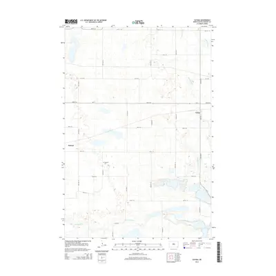
2014 Map of Cayuga
USGS Topo · Published 2014About this map
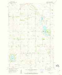
Cayuga and Rutland anchor this rural Sargent County landscape, where the prairie grid of section roads meets the natural curves of the Wild Rice River. The river system defines the southern reaches of the map, flowing toward the significant waters of Lake Tewaukon. This 2014 survey documents a classic North Dakota agricultural layout, characterized by numerous small prairie potholes and wetlands scattered between the established townships.
Find a feature on this map
24 named features on this map. Tap any name to fly to it.
Don’t see what you’re looking for? This feature index may not catch every label — zoom into the map to look around manually.
Map Details
Editions of this 2014 Cayuga Map
This is the sole edition of this map. No revisions or reprints were ever made.
Other maps of this area
1907 · Wyndmere
USGS Topo · 1:125,000
1953 · Milbank
USGS Topo · 1:250,000

1953 · Fargo
USGS Topo · 1:250,000

1956 · Fargo
USGS Topo · 1:250,000
1956 · Havana
USGS Topo · 1:24,000
1958 · Milbank
USGS Topo · 1:250,000
1958 · Marlow
USGS Topo · 1:24,000
1958 · Rutland
USGS Topo · 1:24,000
1958 · Veblen NE
USGS Topo · 1:24,000
1958 · Cayuga NW
USGS Topo · 1:24,000