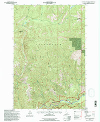
1994 Map of Cayuse Junction
USGS Topo · Published 1997About this map
The Lewis and Clark National Historic Trail threads across the northern ridges of this landscape, following the high ground above Cayuse Creek and the Williams Range. This portion of the Clearwater National Forest is defined by its dramatic drainage systems, where the Lochsa River carves the southern boundary and numerous tributaries like Papoose Creek and Squaw Creek descend from the interior divides. The map documents localized infrastructure within the wilderness, including Snowbank Camp and the Wendover Ridge Rest Site, which provide support for travelers on the historic corridor. Near the river, the small outposts of Wendover and Whitehouse sit along the primary travel route, while higher elevations contain the Cold Storage Saddle and Squaw Saddle, names that reflect the era of pack-train transport and early forest management. The boundary between Clearwater County and Idaho County cuts through the northern sector, crossing Silver Creek in a region characterized by steep vertical relief.
Find a feature on this map
23 named features on this map. Tap any name to fly to it.
Don’t see what you’re looking for? This feature index may not catch every label — zoom into the map to look around manually.
Map Details
Editions of this 1994 Cayuse Junction Map
This is the sole edition of this map. No revisions or reprints were ever made.
Other maps of this area

1911 · Lolo
USGS Topo · 1:250,000

1913 · Lolo
USGS Topo · 1:250,000

1956 · Hamilton
USGS Topo · 1:250,000

1959 · Hamilton
USGS Topo · 1:250,000

1960 · Hamilton
USGS Topo · 1:250,000

1964 · Hamilton
USGS Topo · 1:250,000

1964 · Rocky Point
USGS Topo · 1:24,000
1964 · Granite Pass
USGS Topo · 1:24,000

1966 · Grave Peak
USGS Topo · 1:24,000
1966 · Rhodes Peak
USGS Topo · 1:24,000