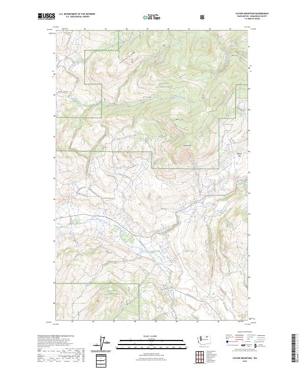
2023 Map of Cayuse Mountain
USGS Topo · Published 2023About this map
Okanogan National Forest dominates the high country of north-central Washington in this topographic survey, where a series of steep drainages feed the larger water systems of the region. The landscape is defined by the prominent Cayuse Mtn and the long expanse of Fourth of July Ridge, which together channel the various branches of Siwash Creek. To the south, the terrain opens into the Aeneas Valley, a significant topographical break where Aeneas Valley Rd follows the path of Peony Creek. The map shows a transition from the high-elevation forest and ridgelines to more level ground at Bigham Flats. This network of forest service roads and local routes like Island Mountain Rd reveals the modern accessibility of these remote highlands, illustrating how contemporary infrastructure overlays the original geological contours of the Bonaparte Creek watershed.
Find a feature on this map
38 named features on this map. Tap any name to fly to it.
Don’t see what you’re looking for? This feature index may not catch every label — zoom into the map to look around manually.
Map Details
Editions of this 2023 Cayuse Mountain Map
This is the sole edition of this map. No revisions or reprints were ever made.
Other maps of this area

1902 · Osoyoos
USGS Topo · 1:125,000

1904 · Osoyoos
USGS Topo · 1:125,000

1954 · Okanogan
USGS Topo · 1:250,000

1957 · Mt. Bonaparte
USGS Topo · 1:62,500

1957 · Tonasket
USGS Topo · 1:62,500

1957 · Oroville
USGS Topo · 1:62,500

1957 · Aeneas Valley
USGS Topo · 1:62,500

1958 · Okanogan
USGS Topo · 1:250,000
1981 · Barker Mtn
USGS Topo · 1:24,000
1981 · Burge Mtn
USGS Topo · 1:24,000