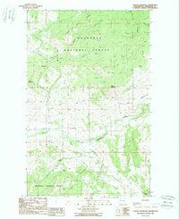
1988 Map of Cayuse Mountain
USGS Topo · Published 1988About this map
The Okanogan National Forest covers much of this high-country landscape in northern Washington during the late 1980s. The terrain is defined by prominent peaks like Cayuse Mountain and Island Mountain, with drainage basins flowing through the North Fork, Middle Fork, and South Fork of Fourth of July Creek. In the lower elevations, the Aeneas Valley provides a focal point for activity, where Bonaparte Creek and Peony Creek converge. Evidence of local transportation and industry is found in the isolated Landing Strip and various Gravel Pits scattered near the watercourses. This survey illustrates the remote character of the region, where numerous Springs and small tributaries like Patterson Creek and Cole Creek support the forest environment and local allotments.
Find a feature on this map
26 named features on this map. Tap any name to fly to it.
Don’t see what you’re looking for? This feature index may not catch every label — zoom into the map to look around manually.
Map Details
Editions of this 1988 Cayuse Mountain Map
This is the sole edition of this map. No revisions or reprints were ever made.
Other maps of this area

1902 · Osoyoos
USGS Topo · 1:125,000

1904 · Osoyoos
USGS Topo · 1:125,000

1954 · Okanogan
USGS Topo · 1:250,000

1957 · Mt. Bonaparte
USGS Topo · 1:62,500

1957 · Tonasket
USGS Topo · 1:62,500

1957 · Oroville
USGS Topo · 1:62,500

1957 · Aeneas Valley
USGS Topo · 1:62,500

1958 · Okanogan
USGS Topo · 1:250,000
1981 · Barker Mtn
USGS Topo · 1:24,000
1981 · Burge Mtn
USGS Topo · 1:24,000