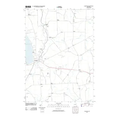
2010 Map of Cazenovia
USGS Topo · Published 2010About this map
Cazenovia Lake anchors the western edge of this Madison County landscape, where the village of Cazenovia sits as a central hub for the surrounding rural communities. The terrain is defined by the winding course of Chittenango Creek as it flows north toward the dramatic drop at Chittenango Falls. This 2010 survey illustrates a region where long-established agriculture and small crossroads settlements like Nelson, Fenner, and Ballina maintain their historic footprints.
Find a feature on this map
97 named features on this map. Tap any name to fly to it.
Don’t see what you’re looking for? This feature index may not catch every label — zoom into the map to look around manually.
Map Details
Editions of this 2010 Cazenovia Map
This is the sole edition of this map. No revisions or reprints were ever made.
Other maps of this area

1895 · Chittenango
USGS Topo · 1:62,500

1895 · Oneida
USGS Topo · 1:62,500

1897 · Cazenovia
USGS Topo · 1:62,500

1898 · Oneida
USGS Topo · 1:62,500

1898 · Chittenango
USGS Topo · 1:62,500

1899 · Cazenovia
USGS Topo · 1:62,500

1902 · Chittenango
USGS Topo · 1:62,500

1902 · Morrisville
USGS Topo · 1:62,500

1902 · Oneida
USGS Topo · 1:62,500

1939 · Oneida
USGS Topo · 1:62,500