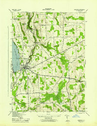
1944 Map of Cazenovia
USGS Topo · Published 1944About this map
Cazenovia Lake and its eastern shores dominate the western edge of this mid-1940s landscape, which centers on the village of Cazenovia. This agricultural and residential area in Madison County is defined by a network of crossroads settlements and small farm communities. To the north, Chittenango Falls State Park preserves the sharp descent of Chittenango Creek, while to the south, Nelson Swamp and Cedar Swamp mark the low-lying glacial terrain. The map is particularly rich for genealogical research, identifying numerous family-named landmarks such as Rowan Corners, Coty Corners, and Abell Corners. Industrial history is noted at Stone Quarry Hill, and the rural educational infrastructure is preserved through sites like School No 5 and Gooden Sch. Local burial grounds, including Evergreen Cem and the Ballou Cem, are clearly delineated alongside early transport routes like the Turnpike Road.
Find a feature on this map
52 named features on this map. Tap any name to fly to it.
Don’t see what you’re looking for? This feature index may not catch every label — zoom into the map to look around manually.
Map Details
Editions of this 1944 Cazenovia Map
This is the sole edition of this map. No revisions or reprints were ever made.
Other maps of this area

1895 · Chittenango
USGS Topo · 1:62,500

1895 · Oneida
USGS Topo · 1:62,500

1897 · Cazenovia
USGS Topo · 1:62,500

1898 · Oneida
USGS Topo · 1:62,500

1898 · Chittenango
USGS Topo · 1:62,500

1899 · Cazenovia
USGS Topo · 1:62,500

1902 · Chittenango
USGS Topo · 1:62,500

1902 · Morrisville
USGS Topo · 1:62,500

1902 · Oneida
USGS Topo · 1:62,500

1939 · Oneida
USGS Topo · 1:62,500