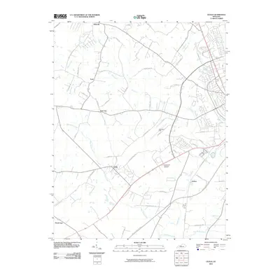
2010 Map of Cecilia
USGS Topo · Published 2010About this map
Cecilia and Rineyville anchor this 2010 survey of Hardin County, Kentucky, where the landscape is defined by the headwaters of the Valley Creek and West Rhudes Creek systems. The map captures a moment of modern transition, showing the expansion of the Elizabethtown Byp and Western Kentucky Pkwy alongside long-established rural communities. Local history researchers will find significant landmarks such as Addington Field and the Elizabethtown Memorial Gardens, while genealogists can trace family-named roads like Hayden School Rd and Cecilia Smiths Mill Rd. Smaller settlements like Saint John, Kraft, and Gaithers illustrate the dispersed residential pattern of the region. The drainage network, featuring Billy Creek and Dyers Spring, remains a central geographic element, dictating the placement of older farmsteads and transport routes across this part of the Commonwealth.
Find a feature on this map
56 named features on this map. Tap any name to fly to it.
Don’t see what you’re looking for? This feature index may not catch every label — zoom into the map to look around manually.
Map Details
Editions of this 2010 Cecilia Map
This is the sole edition of this map. No revisions or reprints were ever made.
Other maps of this area

1932 · Big Clifty
USGS Topo · 1:62,500

1935 · Elizabethtown
USGS Topo · 1:48,000

1936 · Vine Grove
USGS Topo · 1:62,500

1938 · Elizabethtown
USGS Topo · 1:62,500

1941 · Ekron
USGS Topo · 1:62,500

1943 · Vine Grove
USGS Topo · 1:62,500

1946 · Colesburg
USGS Topo · 1:24,000

1946 · Vine Grove
USGS Topo · 1:24,000

1946 · Vine Grove
USGS Topo · 1:62,500

1947 · Ekron
USGS Topo · 1:62,500