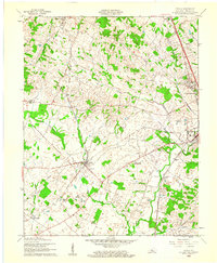
1960 Map of Cecilia
USGS Topo · Published 1961About this map
Illinois Central and Louisville and Nashville rail lines converge at Cecilia, creating a vital transport hub for Hardin County during the early 1960s. This survey illustrates a landscape defined by small rural settlements like Kraft, Gaithers, and Hansbrough situated amidst the meandering paths of Billy Creek and Valley Creek. Local social and religious centers are well-documented, including Bethlehem Academy and St Johns Ch, reflecting the deep-rooted community foundations of the era.
Find a feature on this map
22 named features on this map. Tap any name to fly to it.
Don’t see what you’re looking for? This feature index may not catch every label — zoom into the map to look around manually.
Map Details
Editions of this 1960 Cecilia Map
This is the sole edition of this map. No revisions or reprints were ever made.
Other maps of this area

1932 · Big Clifty
USGS Topo · 1:62,500

1935 · Elizabethtown
USGS Topo · 1:48,000

1936 · Vine Grove
USGS Topo · 1:62,500

1938 · Elizabethtown
USGS Topo · 1:62,500

1941 · Ekron
USGS Topo · 1:62,500

1943 · Vine Grove
USGS Topo · 1:62,500

1946 · Colesburg
USGS Topo · 1:24,000

1946 · Vine Grove
USGS Topo · 1:24,000

1946 · Vine Grove
USGS Topo · 1:62,500

1947 · Ekron
USGS Topo · 1:62,500