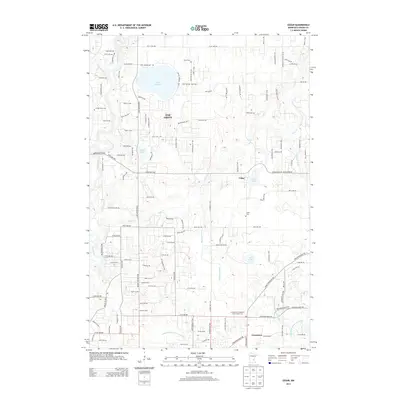
2013 Map of Cedar
USGS Topo · Published 2013About this map
Oak Grove and the neighboring settlements of Cedar and Constance define this corner of Anoka County, where suburban expansion meets a complex network of glacial lakes and drainage ditches. The landscape is heavily influenced by water, featuring the prominent Lake George at its center and the winding path of the Rum River along the western edge, crossed by the Gillespie Bridge. For local historians and genealogists, the map identifies several significant burial sites, including W Oak Grove Cem, Pierce Cem, Cedar Cem, and the Constance Evangelical Free Church Cem. The area's agricultural and drainage history is visible through a series of numbered waterworks like County Ditch Number Thirtyseven and County Ditch Number Fiftyeight, which channel water toward Cedar Cr and Mahoney Brook. This 2013 survey provides a detailed look at the modern road grid as it carves through the remaining wetlands and wooded parcels of the Anoka Sand Plain.
Find a feature on this map
124 named features on this map. Tap any name to fly to it.
Don’t see what you’re looking for? This feature index may not catch every label — zoom into the map to look around manually.
Map Details
Editions of this 2013 Cedar Map
This is the sole edition of this map. No revisions or reprints were ever made.
Other maps of this area

1902 · White Bear
USGS Topo · 1:62,500

1902 · Anoka
USGS Topo · 1:62,500

1916 · St. Francis
USGS Topo · 1:62,500

1919 · St. Francis
USGS Topo · 1:62,500

1953 · Stillwater
USGS Topo · 1:250,000

1955 · Circle Pines
USGS Topo · 1:24,000

1955 · Anoka
USGS Topo · 1:24,000

1955 · Coon Rapids
USGS Topo · 1:24,000

1955 · Isanti
USGS Topo · 1:62,500

1955 · Anoka
USGS Topo · 1:62,500