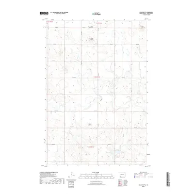
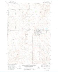
2018 Map of Cedar Butte
USGS Topo · Published 2018About this map
Spring Butte rises as a prominent landmark in the northern reaches of this North Dakota landscape, situated just south of the Union Cem / Spring Butte Cem. The terrain is defined by a series of high points and drainage systems, including Robbers Butte to the south and the eponymous Cedar Butte in the northeastern corner. These elevations overlook a network of seasonal and permanent watercourses, most notably Cedar Creek, which meanders through the central sections of the map. In the southern portion, North Lemmon Lake and the headwaters of Duck Cr illustrate the hydrological patterns of the region. The map reveals a strictly regulated section-line road grid, such as Watros Rd, which reflects the systematic land division and agricultural settlement patterns characteristic of the Great Plains during the late twentieth and early twenty-first centuries.
Find a feature on this map
28 named features on this map. Tap any name to fly to it.
Don’t see what you’re looking for? This feature index may not catch every label — zoom into the map to look around manually.
Map Details
Editions of this 2018 Cedar Butte Map
This is the sole edition of this map. No revisions or reprints were ever made.
Other maps of this area
1953 · Dickinson
USGS Topo · 1:250,000

1954 · Lemmon
USGS Topo · 1:250,000
1957 · Dickinson
USGS Topo · 1:250,000

1957 · Lemmon
USGS Topo · 1:250,000
1974 · Nason Hill
USGS Topo · 1:24,000
1974 · Plum Butte NE
USGS Topo · 1:24,000
1974 · Cedar Butte
USGS Topo · 1:24,000
1974 · Long Butte
USGS Topo · 1:24,000
1974 · White Butte
USGS Topo · 1:24,000
1974 · Lemmon
USGS Topo · 1:24,000