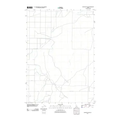
2010 Map of Cedar Butte SW
USGS Topo · Published 2010About this map
Medicine Lodge Creek winds through the northern portion of this high desert terrain, serving as a vital water source for the agricultural landscape of Jefferson County. The network of section-line roads, including South Slope Farms Rd and Camas Monteview Rd, reveals the organized layout of rural Idaho farming operations in the early 21st century. This survey documents the intersection of modern transportation routes like Snake River Plain Rd with the natural drainage patterns of the Snake River Plain. The sparse distribution of named features highlights the region's character as a working agricultural frontier defined by large-scale irrigation and distance.
Find a feature on this map
10 named features on this map. Tap any name to fly to it.
Don’t see what you’re looking for? This feature index may not catch every label — zoom into the map to look around manually.
Map Details
Editions of this 2010 Cedar Butte SW Map
This is the sole edition of this map. No revisions or reprints were ever made.
Other maps of this area

1955 · Dubois
USGS Topo · 1:250,000

1955 · Idaho Falls
USGS Topo · 1:250,000

1958 · Dubois
USGS Topo · 1:250,000

1958 · Idaho Falls
USGS Topo · 1:250,000

1964 · Lone Butte
USGS Topo · 1:24,000

1964 · Small
USGS Topo · 1:24,000

1964 · Cedar Butte SW
USGS Topo · 1:24,000

1964 · Mud Lake NW
USGS Topo · 1:24,000

1964 · Rays Lake
USGS Topo · 1:24,000

1964 · Cedar Butte SE
USGS Topo · 1:24,000