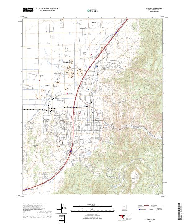
2023 Map of Cedar City
USGS Topo · Published 2023About this map
Southern Utah University and George Wythe University anchor the academic core of this community, where the high desert floor meets the sharp ascent of the Hurricane Cliffs. The landscape is defined by the transition from the relatively flat Cedar Valley into the complex drainages of Coal Creek and Iron Bowl Creek. To the north, the settlement of Enoch marks the edge of the valley, while the residential area of Cedar Highlands is positioned on the steep slopes of Cedar Mtn. Civic infrastructure is clearly delineated, from the Iron County Court House in the city center to the Cedar City Regional Airport on the western outskirts. The topography rises dramatically eastward toward White Mtn and Lone Tree Mtn, revealing the geological transition between the Great Basin and the Colorado Plateau. Local history is preserved at the Cedar City Cem and noted at geographical landmarks like The Knoll and The Iron Bowl.
Find a feature on this map
89 named features on this map. Tap any name to fly to it.
Don’t see what you’re looking for? This feature index may not catch every label — zoom into the map to look around manually.
Map Details
Editions of this 2023 Cedar City Map
This is the sole edition of this map. No revisions or reprints were ever made.
Other maps of this area

1885 · St. George
USGS Topo · 1:250,000

1886 · Kanab
USGS Topo · 1:250,000

1891 · St. George
USGS Topo · 1:250,000

1949 · Cedar City NW
USGS Topo · 1:24,000

1950 · Cedar City NW
USGS Topo · 1:24,000

1950 · Kanarraville
USGS Topo · 1:24,000

1950 · Enoch
USGS Topo · 1:24,000

1950 · Cedar City
USGS Topo · 1:24,000

1950 · Enoch
USGS Topo · 1:62,500

1950 · Cedar City
USGS Topo · 1:62,500