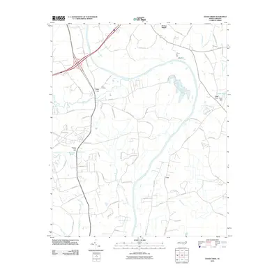
2010 Map of Cedar Creek
USGS Topo · Published 2010About this map
The Cape-Fear-River serves as the dominant geographical feature of this 2010 landscape, winding through a region where residential development and agricultural plots meet dense waterway networks. Near the river's bend, the settlement of Grays Creek is anchored by the Grays Creek Church and the nearby Evans Cemetery, providing a focal point for local genealogy and history. The eastern portion of the map is defined by the Cedar Creek settlement and the Dudley Pond Dam, which regulates the flow of local tributaries.
Find a feature on this map
67 named features on this map. Tap any name to fly to it.
Don’t see what you’re looking for? This feature index may not catch every label — zoom into the map to look around manually.
Map Details
Editions of this 2010 Cedar Creek Map
This is the sole edition of this map. No revisions or reprints were ever made.
Other maps of this area

1948 · Fayetteville
USGS Topo · 1:62,500

1949 · Vander
USGS Topo · 1:24,000

1950 · Fayetteville
USGS Topo · 1:24,000

1953 · Florence
USGS Topo · 1:250,000

1953 · Raleigh
USGS Topo · 1:250,000

1954 · Florence
USGS Topo · 1:250,000

1954 · Raleigh
USGS Topo · 1:250,000

1957 · Vander
USGS Topo · 1:24,000
1957 · Fayetteville
USGS Topo · 1:24,000

1957 · Fayetteville
USGS Topo · 1:62,500