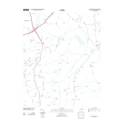
2013 Map of Cedar Creek
USGS Topo · Published 2013About this map
The Cape Fear River winds through this Cumberland County landscape, serving as a primary geographical anchor for the communities of Grays Creek and Cedar Creek. In the northwestern corner, the Fayetteville Regional Airport /Grannis Field establishes a major transportation presence, while the smaller Grays Creek Airport sits further south. The settlement of Lena and numerous rural residential corridors like Grays Creek Church Rd reflect the area's modern growth while maintaining traditional land patterns. Waterways such as Rockfish Cr, Big Sandy Run, and Locks Creek drain into the river, creating a complex hydrologic network that includes localized features like Rainbow Pond and the Hair Canal. This 2013 survey illustrates the balance between the expanding infrastructure of the Fayetteville periphery and the established rural character of the North Carolina coastal plain.
Find a feature on this map
156 named features on this map. Tap any name to fly to it.
Don’t see what you’re looking for? This feature index may not catch every label — zoom into the map to look around manually.
Map Details
Editions of this 2013 Cedar Creek Map
This is the sole edition of this map. No revisions or reprints were ever made.
Other maps of this area

1948 · Fayetteville
USGS Topo · 1:62,500

1949 · Vander
USGS Topo · 1:24,000

1950 · Fayetteville
USGS Topo · 1:24,000

1953 · Florence
USGS Topo · 1:250,000

1953 · Raleigh
USGS Topo · 1:250,000

1954 · Florence
USGS Topo · 1:250,000

1954 · Raleigh
USGS Topo · 1:250,000

1957 · Vander
USGS Topo · 1:24,000
1957 · Fayetteville
USGS Topo · 1:24,000

1957 · Fayetteville
USGS Topo · 1:62,500