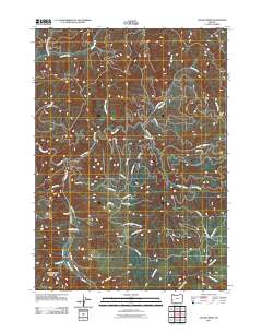
2011 Map of Cedar Creek
USGS Topo · Published 2011About this map
The Williams River flows through this corner of Douglas County, carving a path alongside the more intricate drainage network of Cedar Creek. This 2011 survey reveals a landscape largely defined by industrial forestry and timber management, evidenced by the dense network of Bureau of Land Management and private roads such as Weyerhauser 8000 Rd and Callahan Rd. Woods Camp stands as a notable human marker within this heavily forested region, while significant landmarks like Green Peak overlook the surrounding valleys. The map documents numerous smaller tributaries, including Gods Thumb Creek, Skip Creek, and Cabin Creek, reflecting the high-density hydrology of the Oregon Coast Range. This record is essential for researchers tracking land use patterns and naming conventions in the timberlands between the river and the peaks.
Find a feature on this map
47 named features on this map. Tap any name to fly to it.
Don’t see what you’re looking for? This feature index may not catch every label — zoom into the map to look around manually.
Map Details
Editions of this 2011 Cedar Creek Map
This is the sole edition of this map. No revisions or reprints were ever made.
Other maps of this area

1928 · Sitkum
USGS Topo · 1:125,000

1955 · Camas Valley
USGS Topo · 1:62,500

1955 · Ivers Peak
USGS Topo · 1:62,500

1955 · Sitkum
USGS Topo · 1:62,500

1955 · Tyee
USGS Topo · 1:62,500

1958 · Roseburg
USGS Topo · 1:250,000

1959 · Roseburg
USGS Topo · 1:250,000

1979 · Roseburg
USGS Topo · 1:100,000
1990 · Cedar Creek
USGS Topo · 1:24,000
1990 · Ivers Peak
USGS Topo · 1:24,000