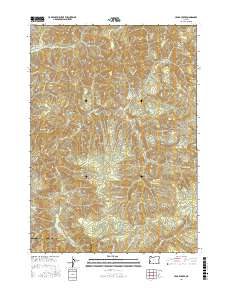
2017 Map of Cedar Creek
USGS Topo · Published 2017About this map
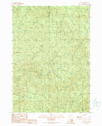
Green Peak dominates the eastern high ground of this coastal range landscape, overlooking a complex drainage system defined by the Williams River and Cedar Creek. The 2017 survey reveals an intensive network of private and administrative timber roads, including the Arrow Creek Rd and numerous WTC 8520 Rd spurs, which weave through the townships of t25s r8w and t26s r9w. This infrastructure underscores the region's primary industrial focus, providing access to remote drainages like Gods Thumb Cr and N Fork Bottom Cr. Near the southern border, the Douglas Co Coos Co line intersects the river valley, marking the transition between jurisdictions. The map serves as a precise guide to the modern logging geography of these mountains, showing how industrial transit follows the natural contours of tributary basins like Fall Cr and Murry Cr.
Find a feature on this map
64 named features on this map. Tap any name to fly to it.
Don’t see what you’re looking for? This feature index may not catch every label — zoom into the map to look around manually.
Map Details
Editions of this 2017 Cedar Creek Map
This is the sole edition of this map. No revisions or reprints were ever made.
Other maps of this area
1928 · Sitkum
USGS Topo · 1:125,000
1955 · Camas Valley
USGS Topo · 1:62,500
1955 · Ivers Peak
USGS Topo · 1:62,500
1955 · Sitkum
USGS Topo · 1:62,500
1955 · Tyee
USGS Topo · 1:62,500

1958 · Roseburg
USGS Topo · 1:250,000

1959 · Roseburg
USGS Topo · 1:250,000
1979 · Roseburg
USGS Topo · 1:100,000
1990 · Cedar Creek
USGS Topo · 1:24,000
1990 · Ivers Peak
USGS Topo · 1:24,000