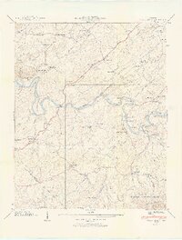
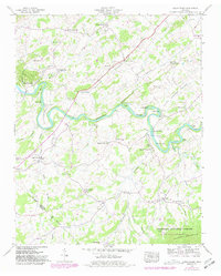
1939 Map of Cedar Creek
USGS Topo · Published 1954About this map
The Nolichucky River meanders through the heart of this East Tennessee landscape, carving deep bends like Cochran Bend and Linebaugh Bend as it separates the lowlands from the rising slopes of Chuckey Mountain. In the late 1930s, the rural economy of Greene and Cocke counties relied on these waters, evidenced by the Meadow Creek Mill and the numerous fords and spans such as Walker Ford and Allen Bridge. The valley floor is a dense network of small family-centered communities and social hubs, marked by a high concentration of country schools and houses of worship like Susong Memorial Ch, Hunt Chapel, and Oak Grove Sch. Timber and agriculture define the ridges, while the Sevier Highway provides the primary artery through Seven Springs Valley, connecting crossroads like Russell Crossroad to the surrounding foothills of the Cherokee National Forest.
Find a feature on this map
63 named features on this map. Tap any name to fly to it.
Don’t see what you’re looking for? This feature index may not catch every label — zoom into the map to look around manually.
Map Details
Editions of this 1939 Cedar Creek Map
5 editions found
Other maps of this area

1883 · Morristown
USGS Topo · 1:125,000

1892 · Greeneville
USGS Topo · 1:125,000

1893 · Mt Guyot
USGS Topo · 1:125,000

1893 · Morristown
USGS Topo · 1:125,000

1894 · Asheville
USGS Topo · 1:125,000

1895 · Morristown
USGS Topo · 1:125,000

1896 · Greeneville
USGS Topo · 1:125,000

1901 · Asheville
USGS Topo · 1:125,000

1904 · Greeneville
USGS Topo · 1:125,000

1912 · Mt Guyot
USGS Topo · 1:125,000