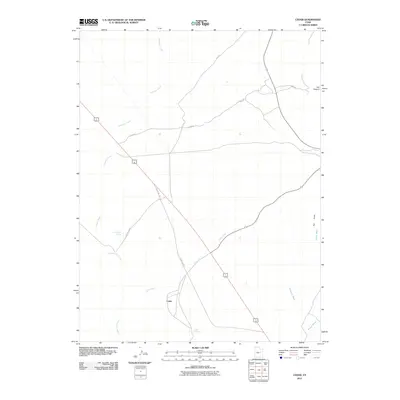
2011 Map of Cedar
USGS Topo · Published 2011About this map
The settlement of Cedar serves as a central point in this Carbon County landscape, situated where the high desert terrain transitions toward significant natural drainages. Modern infrastructure follows historical corridors, with Pole Rd and Cedar Rd cutting through the arid plains to connect remote landmarks. The hydrography of the region is defined by seasonal washes and reliable water sources such as Good Water Spring and Coon Spring, which likely dictated early land use and transit patterns in this part of Utah. Multiple watercourses, including Icelander Creek and Horse Creek, converge and diverge across the quadrangle, illustrating the complex drainage system of the basin. Elevation changes become more pronounced toward the eastern margin, where The Cove and the mouth of Fan Canyon mark the beginning of more varied relief. These geographic features, along with Grassy Trail Creek, highlight the essential relationship between water access and habitation in this environment.
Find a feature on this map
15 named features on this map. Tap any name to fly to it.
Don’t see what you’re looking for? This feature index may not catch every label — zoom into the map to look around manually.
Map Details
Editions of this 2011 Cedar Map
This is the sole edition of this map. No revisions or reprints were ever made.
Other maps of this area

1886 · Price River
USGS Topo · 1:250,000

1896 · Price River
USGS Topo · 1:250,000

1915 · Sunnyside
USGS Topo · 1:62,500

1915 · Wellington
USGS Topo · 1:62,500

1948 · Woodside
USGS Topo · 1:62,500

1949 · Woodside
USGS Topo · 1:62,500

1950 · Woodside
USGS Topo · 1:62,500

1956 · Price
USGS Topo · 1:250,000

1960 · Price
USGS Topo · 1:250,000

1962 · Price
USGS Topo · 1:250,000