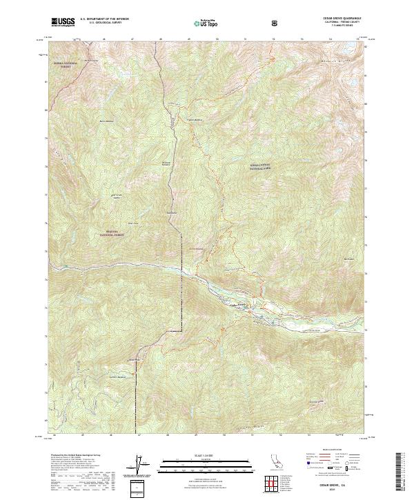
2021 Map of Cedar Grove
USGS Topo · Published 2021About this map
Kings Canyon National Park and Sequoia National Forest meet in this 2021 study of the high Sierra Nevada landscape. The settlement of Cedar Grove serves as the focal point for activity along the South Fork Kings River, where the Kings Wild and Scenic River designation highlights the protected status of these waters. The presence of Sheep Creek CG and Moraine CG, along with the CG Heliport, illustrates the infrastructure developed to manage public access and safety within the deep glacial canyon. High peaks and ridges dominate the surrounding area, from Mt Harrington in the north to Sentinel Dome and Sentinel Ridge in the south. A dense network of trails, including the Cedar Grove Overlook Trl and Kennedy Pass South Trl, reveals how these lands are traversed across the Monarch Divide and through meadows like Wildman Meadow.
Find a feature on this map
61 named features on this map. Tap any name to fly to it.
Don’t see what you’re looking for? This feature index may not catch every label — zoom into the map to look around manually.
Map Details
Editions of this 2021 Cedar Grove Map
This is the sole edition of this map. No revisions or reprints were ever made.
Other maps of this area

1903 · Tehipite
USGS Topo · 1:125,000

1905 · Tehipite
USGS Topo · 1:125,000

1948 · Fresno
USGS Topo · 1:250,000

1952 · Tehipite Dome
USGS Topo · 1:62,500

1953 · Marion Peak
USGS Topo · 1:62,500

1955 · Fresno
USGS Topo · 1:250,000

1956 · Fresno
USGS Topo · 1:250,000

1956 · Giant Forest
USGS Topo · 1:62,500
1956 · Triple Divide Peak
USGS Topo · 1:62,500

1958 · Fresno
USGS Topo · 1:250,000