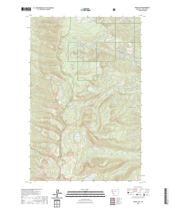
2024 Map of Cedar Lake
USGS Topo · Published 2024About this map
The high elevations of the Mission Range dominate this Lake County landscape, where the protected terrain of the Mission Mountains Wilderness and Flathead National Forest meet. This survey illustrates a complex alpine watershed, with drainage systems such as Skidoo Creek, Fatty Creek, and the North Fork Cedar Creek carving through steep ridges. The map highlights significant topographical landmarks including Moss Peak, Cedar Peak, and the distinctive Minesinger Ridge to the southwest.
Find a feature on this map
35 named features on this map. Tap any name to fly to it.
Don’t see what you’re looking for? This feature index may not catch every label — zoom into the map to look around manually.
Map Details
Editions of this 2024 Cedar Lake Map
This is the sole edition of this map. No revisions or reprints were ever made.
Other maps of this area

1920 · Flathead Lake
USGS Topo · 1:125,000

1955 · Choteau
USGS Topo · 1:250,000

1956 · Wallace
USGS Topo · 1:250,000

1957 · Choteau
USGS Topo · 1:250,000

1958 · Choteau
USGS Topo · 1:250,000

1960 · Wallace
USGS Topo · 1:250,000

1962 · Choteau
USGS Topo · 1:250,000

1964 · Bull Island
USGS Topo · 1:24,000

1964 · East Bay
USGS Topo · 1:24,000

1964 · Ronan
USGS Topo · 1:24,000