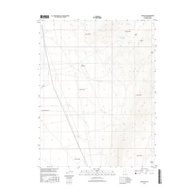
2017 Map of Cedar Pass
USGS Topo · Published 2017About this map
Clay Spring and the S Cedar Wash Reservoir provide critical water sources in this arid stretch of Millard County. The landscape is defined by its drainage systems and mountain transitions, where the Burbank Hills rise above the surrounding flats. Important travel corridors are marked by Cedar Pass and Juniper Pass, offering natural routes through the higher terrain.
Find a feature on this map
18 named features on this map. Tap any name to fly to it.
Don’t see what you’re looking for? This feature index may not catch every label — zoom into the map to look around manually.
Map Details
Editions of this 2017 Cedar Pass Map
This is the sole edition of this map. No revisions or reprints were ever made.
Other maps of this area

1949 · Garrison
USGS Topo · 1:62,500

1951 · Garrison
USGS Topo · 1:62,500

1953 · Richfield
USGS Topo · 1:250,000

1956 · Lund
USGS Topo · 1:250,000

1958 · Richfield
USGS Topo · 1:250,000

1960 · Lund
USGS Topo · 1:250,000

1960 · Burbank Hills
USGS Topo · 1:62,500

1971 · Tunnel Spring
USGS Topo · 1:24,000

1971 · Mormon Gap
USGS Topo · 1:24,000
1972 · Tweedy Wash
USGS Topo · 1:24,000