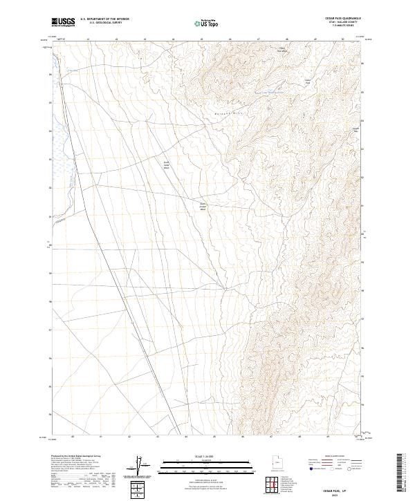
2023 Map of Cedar Pass
USGS Topo · Published 2023About this map
Burbank Hills anchor the central topography of this Millard County landscape, defining the arid drainage patterns of the Great Basin. The rugged terrain is carved by seasonal watercourses, including South Cedar Wash, South Juniper Wash, and the prominent Cedar Pass Wash. These drainages converge toward the west, where Lake Creek flows along the base of the hills, passing near Clay Spring. Human presence is marked by essential water management and transit routes through this high-desert environment. South Cedar Wash Reservoir serves as a critical catchment in the upper elevations, while Burbank Rd provides the primary access route across the valley. The map details the natural corridors formed by Cedar Pass and Juniper Pass, which have long dictated movement through the hills.
Find a feature on this map
10 named features on this map. Tap any name to fly to it.
Don’t see what you’re looking for? This feature index may not catch every label — zoom into the map to look around manually.
Map Details
Editions of this 2023 Cedar Pass Map
This is the sole edition of this map. No revisions or reprints were ever made.
Other maps of this area

1949 · Garrison
USGS Topo · 1:62,500

1951 · Garrison
USGS Topo · 1:62,500

1953 · Richfield
USGS Topo · 1:250,000

1956 · Lund
USGS Topo · 1:250,000

1958 · Richfield
USGS Topo · 1:250,000

1960 · Lund
USGS Topo · 1:250,000

1960 · Burbank Hills
USGS Topo · 1:62,500

1971 · Tunnel Spring
USGS Topo · 1:24,000

1971 · Mormon Gap
USGS Topo · 1:24,000
1972 · Tweedy Wash
USGS Topo · 1:24,000