
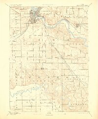
1891 Map of Cedar Rapids
USGS Topo · Published 1891About this map
Cedar Rapids sits at the heart of a rapidly industrializing river valley in this late 19th-century landscape, defined by a convergence of major rail lines and powerful waterways. The city's growth is mirrored by the extensive reach of the Chicago and Northwestern R. R. and the Burlington Cedar Rapids and Northern Railroad, which cut through the rolling terrain toward smaller outposts like Ely and Shueyville. To the south, the winding course of the Iowa River marks a sharp contrast to the more developed Cedar River corridor, showing the early footprints of settlements like North Liberty. The map reveals the intricate drainage patterns of Prairie Creek and Abbys Creek, alongside the established township boundaries of Rapids, College, and Putnam, offering a clear view of the rural-to-urban transition in eastern Iowa before the turn of the century.
Find a feature on this map
29 named features on this map. Tap any name to fly to it.
Don’t see what you’re looking for? This feature index may not catch every label — zoom into the map to look around manually.
Map Details
Editions of this 1891 Cedar Rapids Map
2 editions found
Other maps of this area

1887 · Cedar Rapids
USGS Topo · 1:62,500

1888 · Shellsburg
USGS Topo · 1:62,500

1888 · Marion
USGS Topo · 1:62,500

1888 · Amana
USGS Topo · 1:62,500

1889 · Marion
USGS Topo · 1:62,500

1889 · Amana
USGS Topo · 1:62,500

1889 · Shellsburg
USGS Topo · 1:62,500

1890 · Anamosa
USGS Topo · 1:62,500

1891 · Oxford
USGS Topo · 1:62,500

1891 · Mechanicsville
USGS Topo · 1:62,500