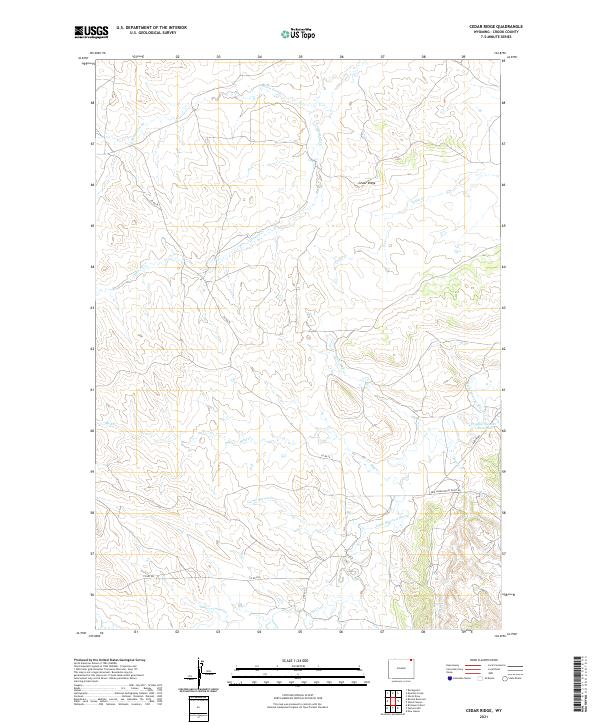
2021 Map of Cedar Ridge
USGS Topo · Published 2021About this map
Cedar Ridge rises as a central topographical landmark in this northeastern Wyoming landscape, where the high plains are carved by an intricate network of drainage prongs and seasonal creeks. The watershed is dominated by the Little Missouri River, which flows through the southeastern portion of the quadrangle. Water management in this arid ranching country is evidenced by the Croppie Number 2 Reservoir, a critical point of interest for understanding the historical land use and livestock operations of Crook County.
Find a feature on this map
20 named features on this map. Tap any name to fly to it.
Don’t see what you’re looking for? This feature index may not catch every label — zoom into the map to look around manually.
Map Details
Editions of this 2021 Cedar Ridge Map
This is the sole edition of this map. No revisions or reprints were ever made.
Other maps of this area

1905 · Devils Tower
USGS Topo · 1:125,000

1954 · Gillette
USGS Topo · 1:250,000

1955 · Gillette
USGS Topo · 1:250,000

1957 · Oshoto
USGS Topo · 1:62,500

1957 · Cedar Ridge
USGS Topo · 1:62,500

1958 · Gillette
USGS Topo · 1:250,000

1962 · Gillette
USGS Topo · 1:250,000
1972 · Bonnie Reservoir
USGS Topo · 1:24,000
1972 · Brislawn School
USGS Topo · 1:24,000
1972 · Rockypoint
USGS Topo · 1:24,000